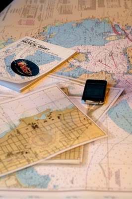
Here are five ways to help your favorite paddler find his or her way this season:
Option 1: Purchase a nautical chart to a destination your favorite paddler longs to go.
Option 2: Buy Chart No. 1, the guide to nautical abbreviations and terms.
Option 3: Buy the AyeTides ap (for paddlers with iPhones), which provides buoy data on tides and currents at thousands of locations around the globe.
Option 4: Photocopy a portion of a chart and laminate it to create a waterproof deck chart. Include a grease pencil for taking notes on the chart.
Option 5: (Best of all…) Treat your favorite paddler to all four!


An alternative source of NOAA nautical charts for paddlers are the “print at home for free BookletCharts” from NOAA. See their web site at http://www.nauticalcharts.noaa.gov/staff/BookletChart.html .
Alternatively, do a screen print from NOAA’s free On-Line Chart Viewer at http://www.nauticalcharts.noaa.gov/mcd/OnLineViewer.html